Publisher's description
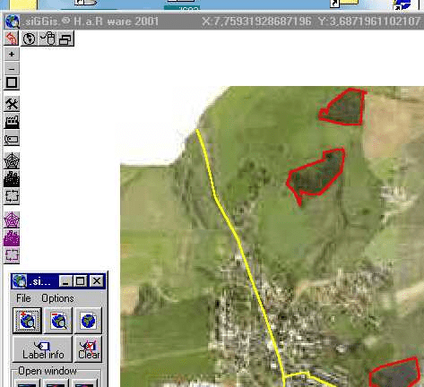
siGGisLT - program is made for simple GIS (includes applets for internet/intranet/PC).With this program it is possible to join other programs or systems and monitor events (Secure of buildings, flood progress,simple GPS...) You can create own vector layers (e.g.: digitize imported orthofotomap - JPEG format, edit databases new layers)save they into *.sig (siGGis),*.dbf files, make own GIS projects . You can join a html document on active geoObject. You can export a view to a graphics file (output formats: *.wmf, *.emf ) import orthofotomap - format JPEG. Applets (internet/intranet) - don't require any action from server, don't need JDBC/ODBC interface.
User comments